
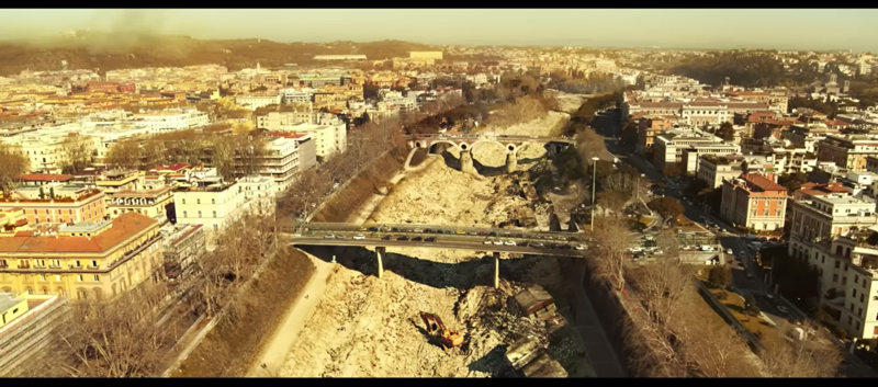
Peigneur Lake is a small reservoir located in Louisiana, United States, a few tens of kilometers from the Gulf of Mexico. The whole region is rich in lakes and bodies of water, due to proximity to the large Mississippi Delta, and the fact that this is the deepest lake in Louisiana shouldn't be as shocking as how it has come to be in recent times.
Going back in time, At the end of the nineteenth century, a wealthy former actor settled on the shores of the lake, and needing water to irrigate the estate, he decided to dig a well on his property. The well unexpectedly, rather than a series of river or lake deposits, met rock, actually salt! In fact, after a few layers of plaster (hydrated calcium sulfate), the workers encountered a rich deposit of halite (millions of years ago it dried up): the common rock salt. It so happened that the well had been dug at the top of what is called a "diapiro" or saline dome.
And this is where the geological “explanation” starts, be patient.
I sali, or better, the evaporite (of which table salt "NaCl" is the main component, together with calcium sulphates, potassium chlorides and other mineralogical species) they are rocks born from the cyclical evaporation of large basins of water, that, like in a pot of water for pasta left too much on the fire, lays down its salts. These are deposited in layers, starting from the least soluble to the most soluble, in a cyclical series of evaporation events that create layers up to hundreds of meters thick.
Evaporites have particular physical properties: they are not very dense but very plastic and this, when they are buried under the weight of subsequent sediments, transforms them into a sort of extremely viscous fluid. Like toothpaste in a tube when squeezed, the salt subjected to high pressures and temperatures "seeks" an escape route upwards. In these conditions it can get to "break through" and make its way into the overlying sediments, forming a dome rising towards the surface.
This structure is called a diapir or saline dome and they are quite common geological events on Earth: think that some can even be seen from space! The saline domes are then the subject of attention from the mining industry, and this is for the salt itself, and because the diapir, going up, it punctured and deformed the more recent sediment layers, forming structures that are often mineralized by hydrocarbons.
Going back to the estate of the rich late 19th century owner, the discovery of salt was quickly exploited, with the construction of a first mine shaft, and the installation of an underground quarry which in the first decades of the twentieth century produced hundreds of thousands of tons of ore every year, employing hundreds of people.
The underground quarry expanded over the course of eighty years of activity, cultivating the salt dome with banks and pillars, down to the bed of the lake and up to a fifth level at well 560 m deep, which required the help of compressors and ventilation shafts for the air.
It is the story of a peaceful coexistence between the lake and the underground quarry, until in 1980 the American oil company Texaco obtains authorization to carry out 2 exploration wells searching for hydrocarbons in the area. The objective of the drilling was in fact to investigate, looking for hydrocarbons, some sandy levels deformed by the rise of the saline diapir.
Two rigs were sent on barges out into the middle of the lake, and drilling work began. Arrived at the depth of 460 meters, one of the two rigs jerked and tilted: the pressure at the well dropped dramatically, and all the mud circulating in the hole was lost. The crews of both barges were immediately evacuated: just in time to notice that a huge whirlpool was forming around the barge, almost as if he had just removed the stopper from an immense bathtub.
Within minutes the flow of water enlarged the bore hole, and the bottom sank further 60 m, creating a maelstrom that engulfed both barges and others 11 boats present in the surroundings that day, along with all the lake water.
Meanwhile in the salt pit, about fifty workers and visitors watched astonished the flow of an enormous quantity of water from the fourth level, no longer exploited for some time. The water, as known, dissolve the salt, and that's why, without hesitation, the miners evacuated the quarry via a freight elevator which shortly after was fired hundreds of meters away from the largest "artificial geyser" in Louisiana.
Meanwhile on the surface, the water that would normally have flowed from Lake Peigneur to the Gulf of Mexico, had reversed direction, leading a huge volume of brackish water to pour into what remained of the lake. Near the well, where the whirlpool had dug the widest and deepest chasm, a "temporary" waterfall of sea water was created 40 meters, the highest the state of Louisiana has ever seen.
It was only by chance and the skill of the miners of the salt quarry, that no one died that day. Also 8 from the 11 boats swallowed by the lake came afloat as the lake filled with water from the gulf, emerging like corks in a bathtub.
But the damage in environmental terms was difficult to quantify: in a few hours a lake of a few meters of essentially fresh water, turned into a brackish basin deep up to 60 meters, completely upsetting the pre-existing ecosystem.
Less complicated was the assessment of the damages suffered by the salt quarry - totally compromised- and from the properties facing the lake: it seems that Texaco offered a million dollar settlement to all the parties involved, and in particular to the company that owns the quarry.
As it turned out later, indeed, it was a sensational miscalculation – it is believed that the cartographic reference system of the wellhead coordinates was incorrectly converted- incorrectly positioning one of the two drilling rigs. This stood at approx 200 meters closer to the quarry area than originally planned, thus causing the crossing of the most northwestern branch of the galleries a 460 meters deep.
To think that a habitat has been completely overturned for such a trivial miscalculation, it helps to reflect on the power we have over the nature that surrounds us, and on the responsibility that each of us should have towards the environment.
Sources
- Nevers Christmas – University of Utah, Salt Lake City
- “Who Pulled the Plug on Lake Peigneur?” Gold Michael, 1981, Science 81 Magazine, November
Credits image: https://it.wikipedia.org/wiki/Categoria:Immagini_Creative_Commons_by_4.0#/media/File:MAPPA_PEIGNEUR.jpeg (Change in the reconstruction of the geological structure starting from Enrico Cabianca's own work)


Leave A Comment